Wildfire liability and climate risk: the case for current spatial data
For utilities operating in fire-prone regions, wildfire risk has moved from a manageable operational concern to an existential financial threat. A single catastrophic event can generate losses that exceed a utility’s entire market capitalization. The most-cited bankruptcy in the sector arose from roughly $30 billion in wildfire liabilities — and under inverse-condemnation doctrine in some states, a utility can be held financially responsible even when it followed every applicable safety regulation. You can operate safely, invest appropriately, comply fully, and still face company-ending liability from one weather event combined with one equipment failure.
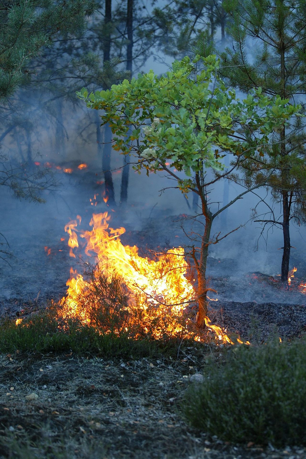
Why the risk keeps accelerating
Wildfire exposure is not static. Climate change is extending fire seasons, raising temperatures, lowering humidity, and turning landscapes into tinderboxes. What were once 50- or 100-year events now recur within a decade, and the geographic footprint is expanding well beyond the original western hotspots. As exposure spreads, insurance markets tighten, capital costs rise, and credit ratings come under pressure across whole regions. Traditional vegetation and maintenance programs, run on annual cycles and stale records, simply cannot keep pace with megafire-scale risk.
The data problem underneath the liability
Almost every mitigation strategy — covered conductors, undergrounding, enhanced vegetation programs, public-safety power shutoffs — depends on knowing, precisely, where your assets and the surrounding vegetation actually are today. Most utilities are making billion-dollar allocation decisions against a base map that is years out of date and was never accurate to begin with, which is exactly why GIS accuracy matters when the downside is catastrophic.
A drive-by capture pass changes the equation. A 360° camera paired with multi-band GPS produces a survey-grade digital twin in a single drive: immersive video, a measurable georeferenced point cloud, and AI-detected asset inventories written straight into your GIS. From that point cloud you can measure vegetation-to-conductor clearance directly in the browser — no truck roll, no climb — and flag every span where encroachment threatens a strike. This is the liability-and-risk lens; the operational crew-tasking workflow is covered separately in vegetation management from the drive.
Current data is a legal asset
Because the twin is always current and built for change detection, you can show regulators, insurers, and courts exactly what conditions were on a given date — a defensible, time-stamped record of diligence. That same accurate base also feeds the broader investment case in grid modernization cost recovery and sits among the strategic worries facing utility executives.
See the capture quality in the video gallery, explore how this applies across our industries, or contact us to discuss your highest-risk corridors. When wildfire risk can no longer be treated as a tail event, current spatial data is the cheapest insurance you can buy.