AI point-cloud classification: from millions of raw points to a structured asset map
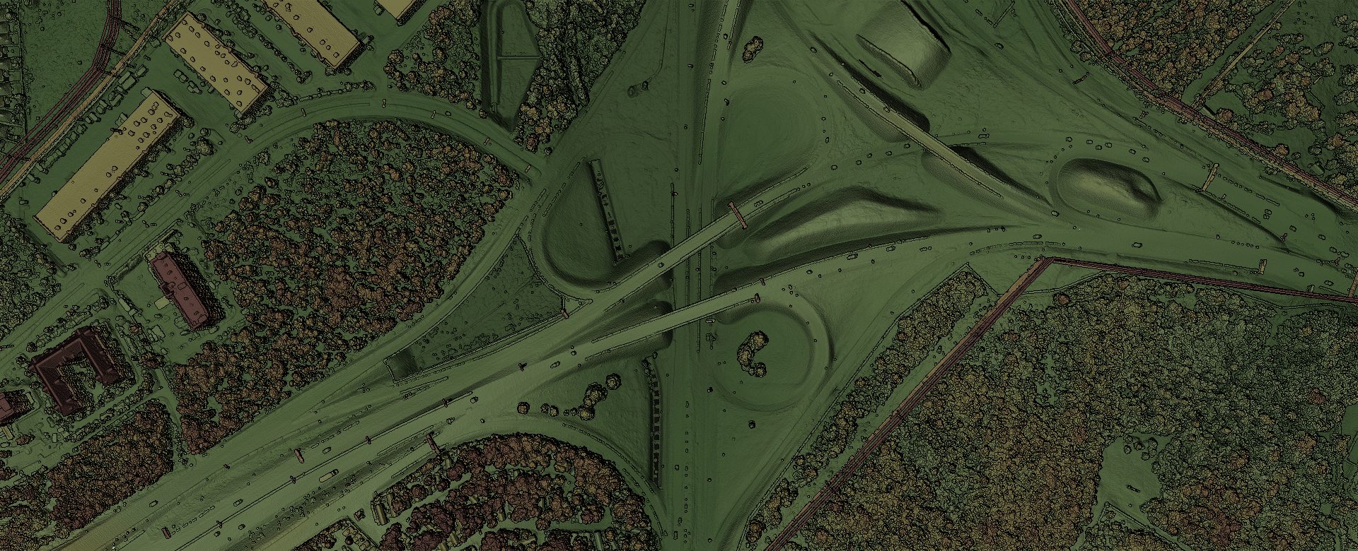
A measurable point cloud tells you where every surface is, down to the centimetre. But on its own it’s still just millions of points — you can measure them, yet nothing in the file says “this is road, that’s a tree, and those are the conductors overhead.” AI point-cloud classification closes that gap: it understands what the points are and turns the raw scan into organised, ready-to-use assets — with no manual tracing, no armies of technicians, and no weeks of desk work.
From raw scan to answers
Every capture is automatically sorted into meaningful categories — ground, road, vegetation, buildings, poles, wires and more — and delivered as structured information you can search, measure and act on. Instead of a raw cloud you still have to interpret, you get the answer the cloud was hiding.
Complete inventories, in a fraction of the time
Poles, lines, signs, trees and structures are identified and inventoried automatically. Classification works hand in hand with 360° asset detection: the imagery says what an object is, the classified cloud gives it a real position, height and footprint. Work that used to take specialists weeks arrives as part of the standard workflow.
Vegetation clearance, on every span
Because vegetation and infrastructure are separated into their own classes, the platform can automatically measure how close trees are to conductors and flag encroachments before they become outages — safety and compliance, quantified, span by span rather than by spot-check.
Built for networks, not just sites
Classification scales from a single site to hundreds of kilometres of corridor without extra manual effort, so you can map an entire network instead of a sample. It’s the natural companion to one drive that yields several deliverables and to drive-by capture that keeps pace with real road speeds.
Drops straight into your GIS
Outputs follow industry-standard formats and land directly in the systems your team already runs on — no bespoke conversion, no lock-in. Your GIS stays the single system of record; classification just keeps it matching the field, and on the next pass powers automatic change detection.
Confidence you can trust
Every classified result carries a confidence score, so your team’s attention goes exactly where it’s needed and the routine majority is handled automatically. Accuracy keeps improving with use — routine data collection becomes a continuously growing, intelligent map of your assets.
Because our classification is driven by the same rich, measurable captures behind everything we do, it delivers more detail, at lower cost, with accuracy that improves over time. One capture. Every asset, understood.
See it in the feature-extraction video, or explore how it serves each industry. Want your network turned into a structured, classified inventory? Talk to us.